
From NOAA Hurricane Center:
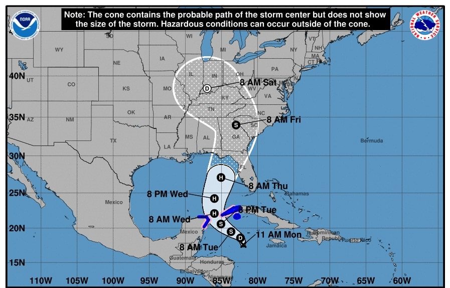
1. The disturbance is forecast to strengthen and be Note: The cone contains the probable path of the storm center but does not show the storm’s size. Hazardous conditions can occur outside of the cone near hurricane strength when it reaches the far northwestern Caribbean Sea Tuesday night.
Tropical storm conditions are expected over portions of western Cuba and the northeastern coast of the Yucatan
Peninsula with hurricane conditions possible.
2. The system is expected to intensify while it moves northward over the eastern Gulf of Mexico, and it could be a major hurricane when it reaches the northeastern Gulf Coast on Thursday.
There is an increasing risk of life-threatening storm surge and damaging hurricane-force winds along portions of the northern and northeastern Gulf Coast, including the Florida Panhandle and portions of the Florida west coast.
Although it is too soon to specify the exact location and magnitude of impacts, residents in these areas should monitor the latest forecast updates and ensure that they have their hurricane plan in place.
ACCUWEATHER:
Hurricane to intensify over Gulf of Mexico, to be strongest to strike US this season
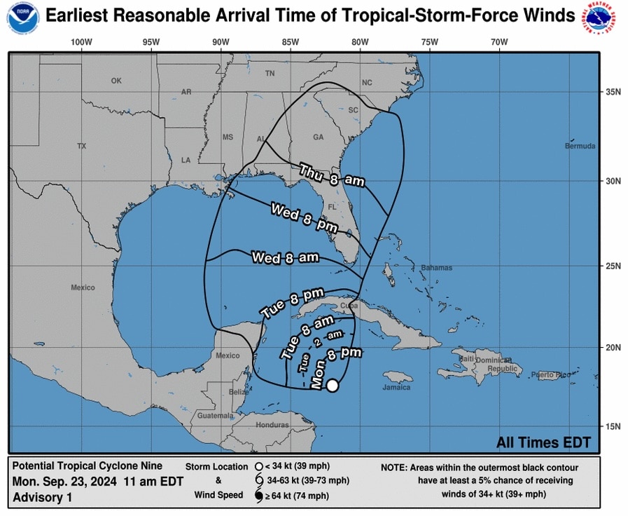
People in the Florida Panhandle, Big Bend region and much of the central and eastern Gulf coast need to complete preparations for major hurricane impacts by Wednesday night before hazardous conditions arrive by Thursday.
By Alex Sosnowski, AccuWeather senior meteorologist
Published Sep 23, 2024 10:17 AM CDT | Updated Sep 23, 2024 11:07 AM CDT
A major hurricane is coming to the Gulf of Mexico. AccuWeather meteorologists warn that communities along the central and eastern Gulf coast only have a few days to prepare for the fast-brewing, quick-moving storm, which can potentially bring life-threatening storm surge, flooding rainfall, and destructive winds. Read more.