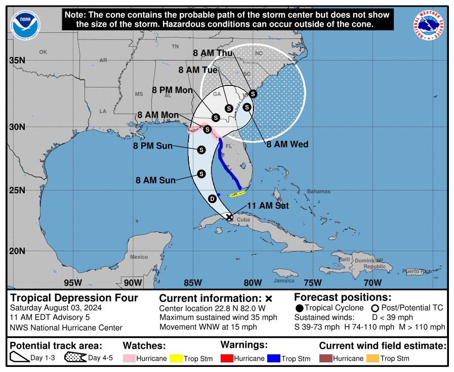
From NOAA Hurricane Center as 11 am EDT
- Heavy rainfall will likely result in locally considerable flash and urban flooding across portions of Florida and the coastal areas of the Southeast this weekend through Thursday morning. River flooding is also expected.
- Hurricane conditions are possible late Sunday in portions of the Florida Gult Coast and Big Bend region, where a Hurricane Watch is in effect. Tropical storm conditions are expected farther south along Florida’s west coast, including the Tampa Bay area and the Dry Tortugas, where Tropical Storm Warnings are in effect.
- There is a danger of life-threatening storm surge inundation along portions of the west coast of Florida from Aripeka to the Aucilla River. Life-threatening storm surge is possible west of Aucilla River to Indian Pass and south of Aripeka to Bonita Beach, including Tampa Bay and Charlotte Harbor.
- Impacts from storm surge, strong winds, and heavy rains are possible elsewhere in Florida and along the southeast coast of the United States from Georgia to North Carolina through the middle of next week, and interests in those areas should continue to monitor the progress of this system. Additional watches and warnings will likely be required later today.
Note: The cone contains the probable path of the storm center but does not show the size of the storm. Hazardous conditions can occur outside of the cone
