We will have Escambia County Public Safety Director Eric Gilmore on “Real News with Rick Outzen” at 7 a.m.
UPDATE
Eric Gilmore:
“This one’s just a mess. Even Mobile Weather, Saturday, God bless ’em, sent out an email saying, ‘Yes, there is an area of disturbance that we’re looking at. We’ll be monitoring this over the next several days.’ And then they put their little statement in there for the first time. I’ve seen ’em do this, ‘Quit watching the models. We don’t know where it’s going to go until it’s a little close to a little further out because the models were anywhere from Texas all the way to the peninsula of Florida and it changed hour by hour.'”
NOAA Hurricane Center
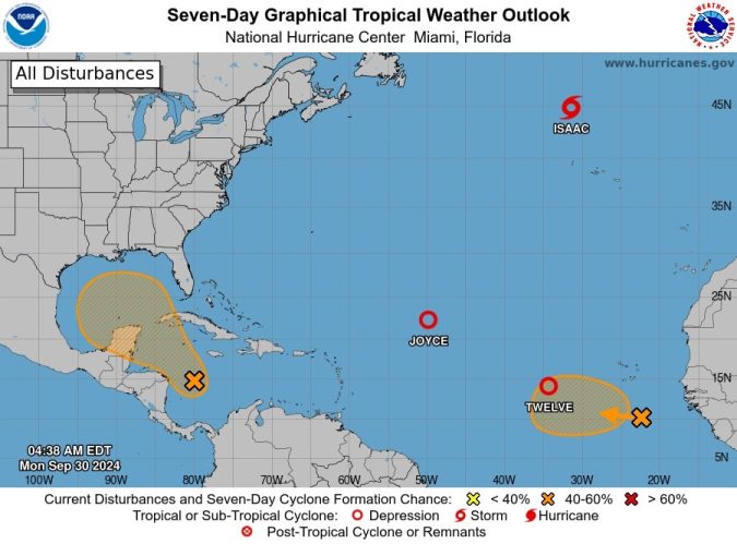
Tropical Weather Outlook – 7 Day Outlook
NWS National Hurricane Center Miami FL
200 AM EDT Mon Sep 30 2024
Western Caribbean Sea and Gulf of Mexico:
A broad area of low pressure located over the western Caribbean Sea
is producing disorganized showers and thunderstorms. Environmental
conditions appear to be conducive for gradual development, and a
tropical depression could form around the middle part of this week
while the disturbance moves slowly west-northwestward. This system
is then expected to move northwestward into the Gulf of Mexico
during the latter portion of this week. Interests in the
northwestern Caribbean Sea and along the U.S. Gulf Coast should
monitor the progress of this system.
* Formation chance through 48 hours…low…near 0 percent.
* Formation chance through 7 days…medium…50 percent.
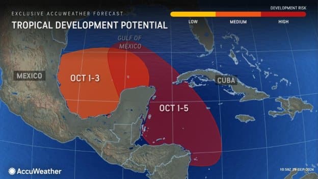
AccuWeather?meteorologists say the area from the western Caribbean to the Gulf of Mexico will remain a potential tropical development zone into the first half of October. Over the next week, one to two tropical storms could be born in this zone and potentially steered across part of the southeastern U.S.


