The National Hurricane Center has issued a potential tropical cyclone advisory for a Gulf of Mexico system that is forecast to become a hurricane while two other Atlantic systems loom. Escambia County Public Safety Director Eric Gilmore will give an update at 8 a.m. on “Real News with Rick Outzen.”
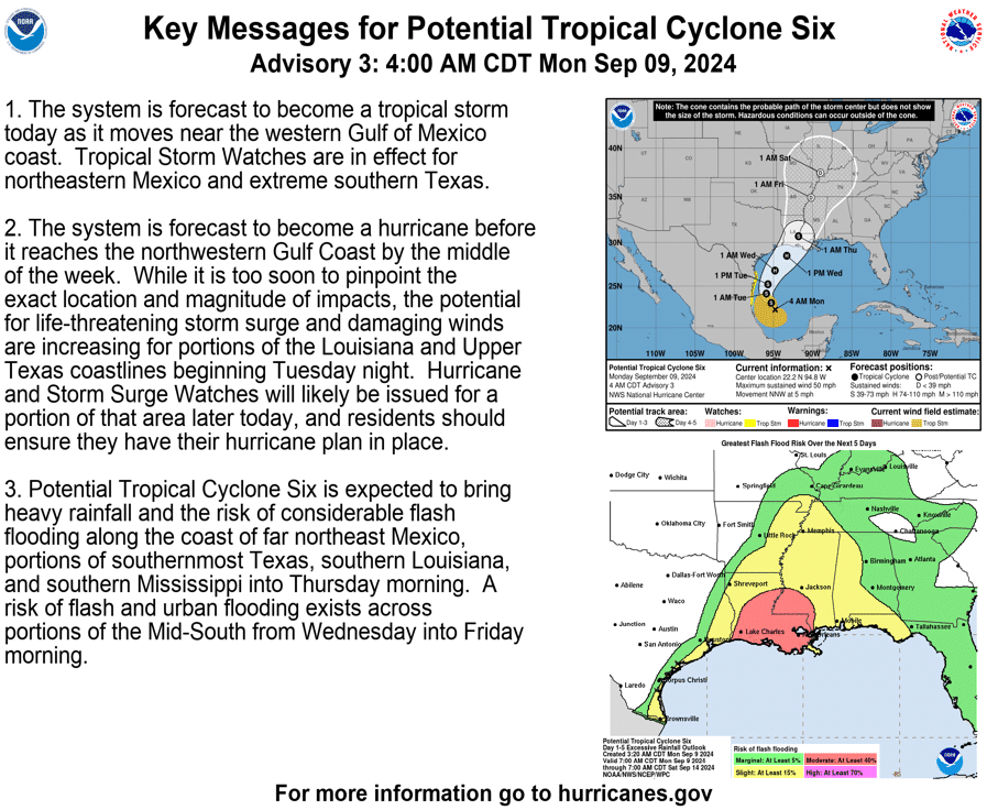
As of the NHC’s 4 a.m. tropical outlook, the broad area of low pressure in the southwestern Gulf of Mexico is expected to become a tropical storm on Monday with significant intensification on Tuesday and is forecast to become a hurricane before it reaches the northwestern U.S. Gulf Coast.
At 400 AM CDT (0900 UTC), the disturbance was centered near latitude
22.2 North, longitude 94.8 West. The system is moving toward the
north-northwest near 5 mph (7 km/h). A slow northwestward to
northward motion is expected over the next day or so, followed by a
faster motion to the northeast beginning late Tuesday. On the
forecast track, the disturbance is expected to move just offshore of
the northern Gulf Coast of Mexico through Tuesday, and approach the
Louisiana and Upper Texas coastline on Wednesday.
Maximum sustained winds are near 50 mph (85 km/h) with higher gusts.
The disturbance is expected to become a tropical storm today, with
more significant intensification forecast to occur on Tuesday. The
system is forecast to become a hurricane before it reaches the
northwestern U.S. Gulf Coast.
* Formation chance through 48 hours… high…90 percent.
* Formation chance through 7 days…high…90 percent.
Tropical-storm-force winds extend outward up to 185 miles (295 km)
from the center.
RAINFALL: Potential Tropical Cyclone Six is expected to bring storm
total rainfall of 4 to 8 inches, with local amounts to 12 inches,
from the coast of far northeast Mexico northward along portions of
the southern Texas Coast and across southern Louisiana and southern
Mississippi into Thursday morning. This rainfall would lead to the
risk of considerable flash and urban flooding.

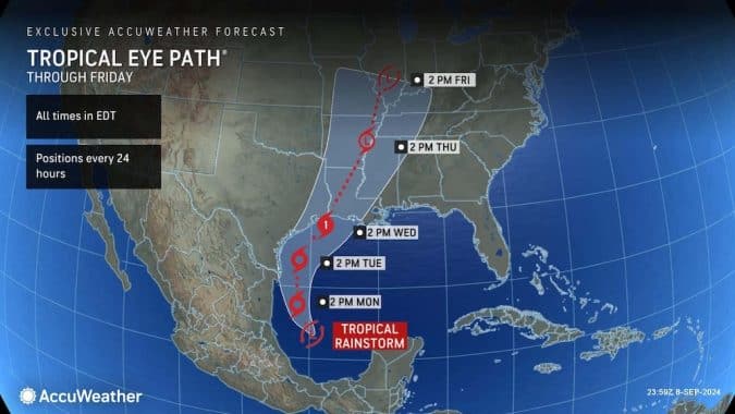
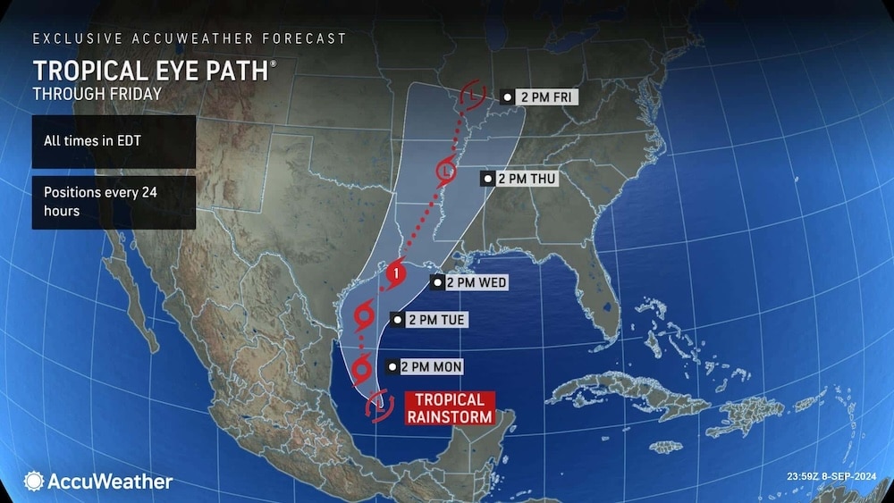
AccuWeather expert meteorologists say a tropical rainstorm brewing in the Gulf of Mexico is forecast to strengthen to a Category 1 hurricane with maximum sustained winds of 74-95 miles per hour on the Saffir-Simpson Hurricane Wind Scale before making landfall near the border of coastal Louisiana and Texas on Wednesday.


