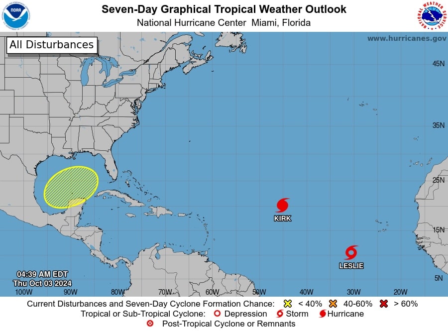
Escambia County Public Safety Director Eric Gilmore shared the latest on Tropical disturbance in the Gulf of Mexico.
Tropical Weather Outlook
NWS National Hurricane Center Miami FL200 AM EDT Thu Oct 3 2024
For the North Atlantic…Caribbean Sea and the Gulf of Mexico:
Active Systems:
The National Hurricane Center is issuing advisories on Hurricane
Kirk, located over the central tropical Atlantic Ocean, and on
recently upgraded Tropical Storm Leslie, located over the eastern
tropical Atlantic Ocean.
1. Gulf of Mexico:
Disorganized showers and thunderstorms over portions of the Gulf of
Mexico are associated with a surface trough. A broad area of low
pressure is likely to develop over the Gulf of Mexico late this
weekend or early next week, but subsequent tropical or subtropical
development could be limited by the system’s potential interaction
with a frontal boundary. Regardless of development, locally heavy
rains could occur over portions of Mexico during the next few days
and over portions of the Florida Peninsula next week.
* Formation chance through 48 hours…low…near 0 percent.
* Formation chance through 7 days…low…30 percent.
ACCUWEATHER
While the activity is still not organized, nearly every indicator suggests that a feature will form in the southwestern Gulf from late this weekend to the middle of next week and track northeastward and across the Florida Peninsula.
“Two pieces of energy will likely combine to spur development in the southwestern Gulf of Mexico in the coming days,” AccuWeather Lead Hurricane Expert Alex DaSilva said. “One piece is heading westward from the Caribbean, and the other piece is associated with a tropical depression near Mexico in the eastern Pacific.”
The consolidation process will be slow and likely to take several days. Read more.
